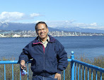
Sunday, February 25, 2007

Nanaimo


Dear Sugeng,
Nanaimo is located in Vancouver Island, about 2 1/2 hours away from Vancouver: 45 minutes drive to Horseshoe Bay ferry terminal and 1 hour 45 minutes ferry ride to Departure Bay, Nanaimo. Vancouver Island itself is about 40 km west of Lower Mainland across the water, and it's size is about 1/4 of Java Island. Victoria is the capital of British Columbia and is the largest city in the Island, and Nanaimo with 80 000 population is the distant second largest city. There are 3 ferries to service Nanaimo - Horseshoe Bay route, the "Queen of Coquitlam", "Queen of Cowichan" and the "Queen of Oak Bay". They are large ferries that each can carry 360 cars and 1500 passengers. It consists of 7 decks, that is the height of a 7 storey tall building. Deck 1 is for engine room, decks 2,3 and 4 are for cars and trucks, decks 5 and 6 are for passengers, and deck 7 for navigational room. The Nanaimo - Horseshoe Bay service runs 8 times daily during winter, but more sailings in summer starting in June to accommodate with the influx of tourists. Tourism is one of the largest industry in British Columbia together with forestry, fishing and mining. The top photo shown is the Horseshoe Bay ferry terminal. The ship that is further away is the "Queen of Oak Bay" on it's way to Departure Bay, Nanaimo. The one that is still on dock is a smaller ferry, a 100 cars and 500 passengers capacity to service the 40 minutes shorter route to Langdale, Sunshine Coast.

Last July 2006, I went for a week to visit a very good friend Tan in Nanaimo, and boarded the "Queen of Oak Bay". Tan and his family immigrated to Canada some 20 odd years ago and opened a restaurant in North Nanaimo. They started the restaurant business in Vancouver a few months after their arrival in Canada. But soon they discovered that there were too many cutthroat competitions around. It was very hard to survive, let alone making a profit, and they were losing money big time. So they looked around for a better alternative and moved to Nanaimo and opened a restaurant there instead. Like most immigrants they work very hard. Essentially it is a family run restaurant business, and everybody has to pitch in, husband, wife, sons, daughters, nieces, nephews and other relatives that happen to come for a visit, have to help and work at the restaurant. I am happy to be treated as one of the family. It is hard work, low profit margins, and therefore the long hours of work to get a decent income. Start at 10 am, and most of the time finish at 2 am next mornings, 7 days a week. They have to, because they need to support their children to go to University, one daughter is attending Dentistry College and one son is in College of Music. They hope that their children will have better jobs than what they now have. They know perfectly well that this is not the best way to make a decent living in Canada, but the only way they know. Having a good education is the best way to go. From time to time they also "have to" send some money to many relatives from both sides in the Old Country, that seems always in need of "emergency" financial helps. Everybody they know in Canada send money back to the Old Country, and they have to send too, and it became a "tradition". The Tan's are very hard workers and very generous too. I admire their spirits. I help them around during lunch time to 3 pm wherever help is needed, sometimes as kitchen help sometimes as a waiter. They did enough help during dinner time. Besides they said they did not want me to work too hard. But I did help them with their paperwork at night time though. They let me stay in their spare bedroom during my one week duration with them.
Here at bottom photo you see me in the kitchen making spring rolls.

I always enjoy the ferry ride during the 1 hour 45 minutes ride to and from Nanaimo. I have been to Vancouver Island a few times in the past. The views of the waterways around Gulf Islands are gorgeous, one of the best in the world. There are probably a dozen populated islands between Lower Mainland and Vancouver Island, and all are always crowded with tourists in summer. I visited one of them 3 years ago, the Saltspring Island for R&R (rest and recreation), and played a couple of rounds of golf. In Nanaimo, in my spare time I visited and explored neighbouring towns: Parksville, Qualicum Beach, Ladysmith and Chemainus. These areas are rich with histories, how the early day pioneers like Robert Dunsmuir who became very rich after discovered coal in 1869 in Nanaimo. Then expanded his empire into logging, shipping and transportation businesses. Nanaimo and Ladysmith were the centre of his operation, and where the first original immigrant settlements developed. People at Chemainus are proud to promote their "town of murals", where the whole communities work together to create large mural paintings that averages 8m x 2m in sizes painted on the outside of building walls across town, and became tourists' attractions. Yes, tourists are really coming to see the hundreds of murals at Chemainus, and help promote the town and the local economy. The murals depicting the history of the areas, about people working in coal, logging, fishing and transportation in the early days. All murals were drawn by local artists and students.

Sunday, February 18, 2007

Crocuses


Dear Elizabeth br Ginting,
These are crocuses, another early plants that start growing in mid winter February. They have a biological alarm clock that wakes them up around this time of year, with flash of beautiful bright color flowers. Their colors vary enormously, but the most common are yellow, mauve, lilac and white. Crocuses are perennial, bulb type flowers called "corms", and belong to the family of irises. They are easy to grow, but require a well drain soil. In winter, squirrels and rodents when their foods are scarce, love to dig the corms from the ground to eat. So the crocuses are planted deeper to deter pests. Crocuses are not natives to the Netherlands, but it was first recorded there in 1560's about crocuses being cultivated. The beauty of crocuses inspired a well known Dutch painter Ambrosius Bosschaert to paint a crocus in 1620, and the original painting is displayed in Louvre Museum. Vancouver avid gardeners generally are having a break between November to January due to the cold winter, and the plants being in dormant state. But in early February gardeners can start enjoying the early blooms of tear drops and crocuses again. And spring time is just around the corner. Before tear drops and crocuses are done, there will be a lot of other flowering plants to start growing and showing their blooms. Everywhere looks alive again. New plants sprouting, replacing the dying olds.

Saturday, February 10, 2007

Queen Elizabeth Park


Dear Elizabeth br Ginting,
Yesterday I went to Queen Elizabeth Park (just like your first name), which is about 30 minutes drive from where I live. The Park is actually sitting on a hill which is the highest point in Vancouver, 500 feet above sea level, and has a panoramic view of Vancouver skyline and the North Shore mountains. It was used to be a stone quarry that was turned into a 130 acres of majestic park in 1950's. The construction was overseen by then Vancouver Chief Horticulturalist William Livingstone. It is one of the best parks in the Lower Mainland, and appears in many tourist's brochures. The Park is visited by nearly 6 million visitors each year to marvel at the exceptional garden plantings and to enjoy the recreational facilities. On top of the hill you will find Bloedel Conservatory for tropical plants and birds (behind me on bottom photo), a restaurant and a parking lot. There are many recreational facilities on the lower area of the park: a pitch&putt golf, 2 duck ponds, a dogs off-leash area, 17 tennis courts, a frisbee park, a lawn bowling, a rose garden, 2 beautiful sunken gardens and a forested arboretum area with trails for strollers.
For the last year there has been a major reconstruction on the parking lot on top of the hill. There is a large crater underneath the parking lot that is used for holding Lower Mainland drinking water reservoir. Because of population growth, it needs to be expanded to hold more water and strengthening it to withstand a major earthquake. It is now completed and open for business as usual: the new parking lot, a new water fountain, a new Celebration Pavilion for weddings or meetings and an open area for sitting and exercising. There were used to be many Tai Chi diehards and Falon Gong groups doing their routines every mornings. But not today. It will probably be very soon, after they found out that the reconstruction is completed. Well 99% completed.
It is still winter in Vancouver, which is officially right up to March 21. The weather is cold, and the deciduous trees are still sleeping, just like the leafless birch and Japanese maple trees shown here with me. But some early plants are already started sprouting, like the "tear drop" white flowers shown on top photo. They have a built in biological alarm clock that set-off and start blooming in early February every year. A sight to behold in an otherwise cold, wet, windy and sometimes snowy Vancouver winter.

Thursday, February 1, 2007

Totem Poles

Dear Hasan Basri,
In Vancouver Stanley Park near Brockton Point there are a group of Totem Poles made by Native Indians. A lot of people come to see them and attracted tourists from all over the world. The Totem Poles are sculptured from big trees, usually red cedar. The Totem Poles are storytelling, the carvings tell story about legends. Or it can be just as an artistic presentations. Europeans in 1700's misunderstood them as frightening statues that the natives are worshipping. But the Totem Poles are never object of worship. Construction of a totem pole never done in a modern method, but always in a traditional methods and with ceremonies, from getting the log from the forest, carving it and erecting it on site. Totem Poles are also used in building their traditional long houses as supporting beams. The traditional long houses are large houses that are occupied by many families. That reminded me of the traditional Batak's long houses in Sumatra, where some of the beams are carved and also occupied by many families. But Batak's traditional long houses are not desirable as living quarters in today's standard anymore, although many are still kept as monument to generation past, and also good for tourist attractions. There are many Native Indians tribe in British Columbia. The Totem Poles that are shown on photo are from the tribes of Kwakwaka'wakw, Hesquiat and Ditidaht. Mouthful aren't they.

Tuesday, January 16, 2007

Vancouver


Dear Udin Tarigan,
The City of Vancouver is named after a British explorer, Captain George Vancouver who came to explore Burrard Inlet in 1792. The Greater Vancouver population is 2.2 millions and is the largest metropolitan city in Western Canada. It was first settled in 1860's as a result of immigration caused by 1858 Fraser Canyon Gold Rush. But developed rapidly from a small lumber mill town into metropolitan centre following the arrival of transcontinental railway in 1887. Over the years since I arrived in Vancouver 26 years ago, I have grown to love the place. It is very beautiful, with Grouse Mountain and surrounding mountains as backdrops, deep sheltered harbour of Burrard Inlet and the lush green of Stanley Park. I watched it grow bigger and bigger into metropolitan city as it is now. I bear witness to many developments taken place. I was always eager to see and marvelled at the construction of major shopping malls from their early stages to their completions: Lansdowne, Coquitlam Centre, Park Royals, Metrotown, Guildford Town Centre, Aberdeen & Parker Places, Yaohan, Surrey Place. I was most impressed with the underground malls at city centre: Pacific Centre, Harbour Centre, Royal Centre and Waterfront Centre, at how they managed to dig large holes underground and built shopping malls.
I also watched with keen interest other major developments to make the city more pleasant place to work and live, the transit system. From electric trolley buses into zero emission low floor trolley and compressed natural gas buses. The one most awesome for me was the construction of the driver less remotely controlled elevated "Skytrain" system. I never got tired of watching them busy building station after station and the guided elevated rails in 1984 till it's completion to just before Expo86. From Surrey to New Westminster, to Burnaby, to Vancouver. The Skytrain was built primarily as a showcase for Expo86, where transportation and communication were the main theme. Expo86 was one catalyst that make Vancouver even greater than it was. The Canada Place Hotel and Convention Centre was built with Federal Government help to stage many conventions during the Expo. I was a proud participant at Expo86 as a volunteer and a ticket holder. Indonesia took part in that Expo, where they displayed their domestic satellite "Palapa" and a traditional boat building without the use of any nails. The Skytrain was expanded further to Lougheed and Brentwood Malls in Burnaby.
But with all the admiration I have with the transit system, to my surprise I seldom use the transit system myself, since going to places in your car is the most convenience way to do. But most people have the same idea, that make the roads seem to be always congested. Major new roads that I looked with keen interest were the widening of #1 freeway from Grandview Hwy to Port Mann Bridge to 6 lanes, and #91 Richmond-Annacis Hwy that continue to Alex Fraser Bridge and South. Fraser River runs from East to West and splits Lower Mainland in two, and bridges will have to be constructed. Alex Fraser Bridge and Arther Laing Bridge were constructed during my time, and both bridges take a lot of heavy traffic every day these days.
The construction of city skyscrapers also give change to its landscape. I saw many constructions of highrises at downtown Vancouver: The Scotia Tower, HSBC Tower, Vancouver Sun Tower, Sheraton Wall Tower, Shaw Tower, WestinBayshore Inn and the many high rise condominiums at Coal Harbour. The Expo land where Expo86 took place, became central to the development of high rise condominiums as well, that always attracted my attention every time I passed by. They are my head turner. But many people think they are an eyesore, a concrete jungle that we can do with less or without.
And when the city is getting bigger, then crimes seem to be just want to tag along and become a headache to the police and the authorities. It is a problem to many cities in North America. Some bigger problems than others for sure. Problems like illicit drugs, burglary, robbery, murder, prostitution. Not to mention with Gangsters, that poses more problematic. There are the Latino gangsters, Vietnamese, Filipinos, Chinese. I am always grateful that the authorities somehow managed to deal with the situation. There is one sore point in the Downtown Eastside area, it is shabby, run down buildings and full of the undesirables, mostly problems with drugs, prostitution and homelessness. Some of them former patients from Riverview Hospital, that can't deal with living by themselves anymore. With the re-construction of Woodward building to trendier shops and residentials, many hopes that the area will become a better place for everybody, especially Chinatown businesses just next to it that have been subjected to this for so long.
Some cities in the world have their own distinct landmark, like San Francisco with it's Golden Gate Bridge, Sydney with it's Opera House and Harbour Bridge. Vancouver has it's Lions Gate Bridge and The Sail at Canada Place. But for me the true landmark is the Stanley Park, the 1000 acres of lush green park close to downtown core. You can play tennis, pitch & putt golf, baseball, cricket; do swimming, cycling and also hiking at many trails that criss-crossing the park surrounded by tall cedar, hemlock and fir trees. In summer I particularly like riding my bike from where I live going through Coal Harbour Seawall, to Stanley Park and back via English Bay. It is a good 3 hours bike ride over 30 km distance, with many stops along the way.
Now many people excited about the coming of 2010 Winter Olympics to Vancouver, which will be staged in Whistler and Vancouver. You can see Vancouver is booming, always busy with constructions of sport facilities, road expansions and new transit lines to airport.

Saturday, January 13, 2007

Riverview Hospital

Dear Dr Titi Sulastri,
You probably are interested to know how people with mental disorder being treated here in Vancouver. They are being taken care of in the Provincial Government "Riverview Hospital" located in Coquitlam. The hospital provides specialized treatment and rehabilitation for patients ages 18 and older. General Hospitals usually have a small unit to take care of temporary stay psychiatric patients. If the patients become unmanageable, too aggressive for example, then a Psychiatrist will refer them to Riverview Hospital to stay for further assessments. The hospital opened in 1913 on 1000 acres of crown land, by using British hospital as a model of operation. It was originally designed for 1800 patients, housed in several buildings that were constructed in stages. The first building was called "West Lawn" built in 1913. Then "Centre Lawn" in 1924, "East Lawn" 1930, "Crease Clinic" 1934, "North Lawn" 1955 and "Valleyview" in 1959. "Pennington Hall" was constructed in 1950 to provide recreational facilities for the patients. Patients population peaked in 1951 to 4630. Incredible isn't it.
The patients are grouped together in wards that have similar type of illness and according to ages to better coordinate their program of treatments. They are divided into "adult programs" for ages 18-64, and "geriatric programs" for 65 and older. The type of mental illness are based according to the terminology of psychiatric and psychoactive substance use disorders that are classified in the "Diagnostic and Statistical Manual DSM-IV".
Wards to include in the "adult programs" are: acute assessment and treatment units (wards located at Centre Lawn), psychiatric intensive care unit (ward E4/East Lawn), refractory psychosis unit (ward F2B/East Lawn), neuropsychiatry units (wards S2&N3/North Lawn), and rehab/community preparation units (Brookside and Leeside buildings).
The "geriatric programs" with wards in: neuropsychiatry geriatric unit (ward S3/North Lawn), geriatric acute and treatment unit (N2/North Lawn), psychotic and affective disorder treatment units (2X&2Y/Valleyview), acute aggressive behaviour rehabilitation units (N1/North Lawn), behaviour stabilization units (wards 3X&3Y/Valleyview) and psycho geriatric extensive treatment units (4X&4Y/Valleyview).

Those are all jumble of words in psychiatric terms. Schizophrenia is the most common type of mental illness, both genetically or drug induced, and many of the programs above are connected in some ways with this illness. The electroconvulsive therapy "ECT" treatments are used at the hospital for patients with severe cases of depression both unipolar and bipolar with some success, but it is always a controversial issue. There is a motto written on the hospital ground that says "transforming mental illness into mental wellness". I think it is more of a clise than anything else, because majority of the patients will never become mental wellness again, due to the severity of their illness. Most of the patients are very long terms.
In 1995 there was a plan to close the hospital. A committee was formed to study and prepare for a replacement. But that was only it, a plan. There were opposition to the hospital closure from strong union employees and from patients' relatives. Also the cost of building a hospital was very expensive, and with the government at that time running a large deficit, they decided not to proceed with the closure. But in 2004 a new government of anti labour union was in power, and the hospital closure was inevitable. A committee already made a recommendation to decentralize the mental hospital into smaller hospitals located in various geographical areas. So the government speed up the closure, as the budget now is easier to manage. Many patients have been moved to new smaller facilities nearer to where they come from. Many buildings at Riverview Hospital are already closed, the patients there are now numbered in the hundreds, and eventually will be completely closed. The large track of crown land now sitting in the desirable booming Coquitlam, will become a source of fund to the Provincial Government, ostensibly to pay for the new facilities.

Thursday, January 4, 2007

Vermilion Pass

Dear Wahban Wibisono,
About 600 km from Vancouver, just at the border between the provinces of British Columbia and Alberta, there is this place called Vermilion Pass. It is part of highway #93 that connect Kootenay Region and Banff in Alberta. It is coincidentally at the border of Kootenay and Banff National Parks. There is no significant building or statue at the site, except for a simple plaque on a stone and a wooden sign in a hastily made small park as shown on this photo. The Vermilion Pass is 1700 m above sea level and has a lot of precipitations. It is situated at the peak of Rocky Mountains Continental Divide. The Rocky Mountains, kind of similar to the "Pegunungan Bukit Barisan" in Sumatra, extend North to Alaska and South to New Mexico in the States. The amazing part about this site is that, any rains that drop to the left on this photo, will "have to" go to the Atlantic Ocean in the East, omigosh, that is 4000 km away. And rains that drop to the right side will go to the Pacific Ocean, 600 km West. In 1858 a British Captain John Palliser led an expedition to Western Canada, split his team in two, and gave his geologist Dr James Hector in charge to map out this area that was very much unknown territory at that time. James Hector then noticed the unusual phenomenon of the site. He gave the name "vermilion" which meant ochre color, the color of clays that were found on the B.C. side of the pass, and used by native to make paint. Probably they should have given the name "Hector Pass" in his honor. When I stopped at this place, as I drove from Radium Hot Springs on my way to Banff, it was pouring rains. And I really could see the rain water that drop to the left, all flowing to the left side to eventually join Altrude Creek to start the journey somehow to the Atlantic. The ones that drop to the right all flowing to join Vermilion River for the journey to the Pacific.